
Welcome to Garys’ Web Page (Updated May 2026)
)
Smith Domain Incorporated
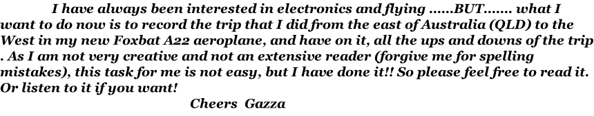
Picture of myself at Caiguna caravan park
It has been quite a while since I did the flight and have left it too long to remember the exact details, but this is it as I remember it.... And as you can see that there are many pictures, so that means I can’t read or write too good.... Four and a half days well spent (or was it) read on ... Tee hee .

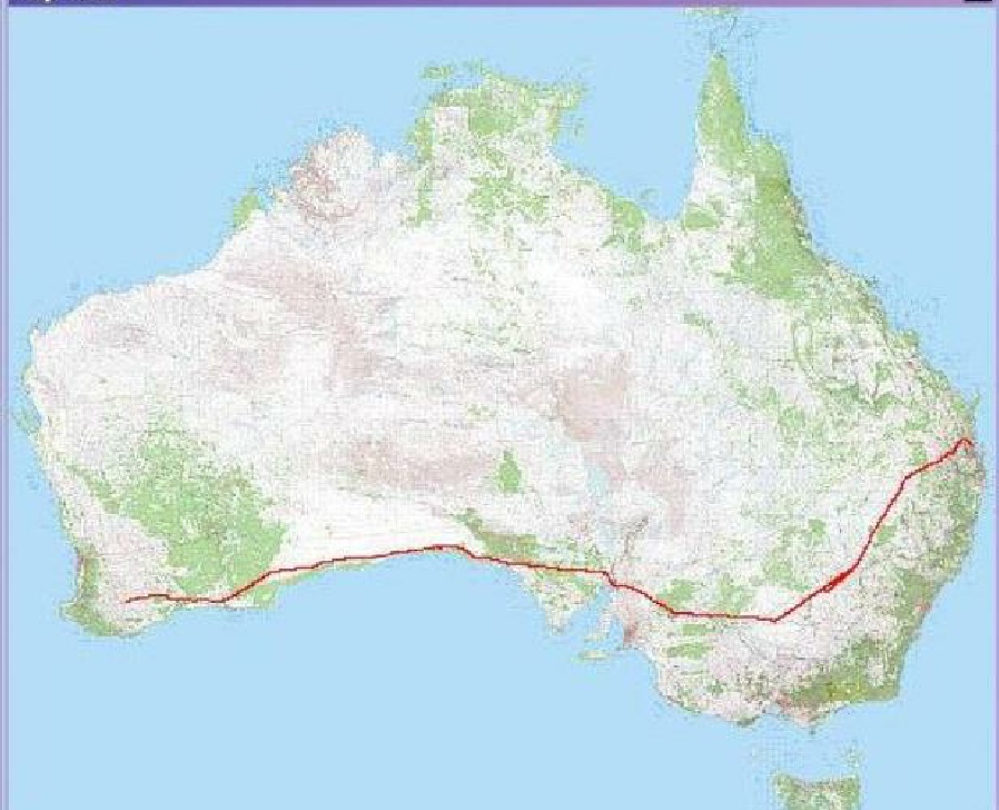
My Trip from Redcliffe Queensland to Katanning WA.
Click this map to see this trip on the google maps, you can zoom right in and see ever turn I made.


Figure 1. The actual flight path from QLD to Western Australia.
I was working at the nickel mine site of Ravensthorpe at the time and I heard that a friend in Northam (Steve Vette CFI) WA was going over to Redcliffe to assist with Noel Halden to fly his new Tecnam home from QLD. It was then that I decided to ask Steve if I could tag along for moral support. I booked the Virgin Blue flight for Tuesday night (19 Feb 2008) and when I knocked off work at Ravensthorpe, I flew to Perth and got there about 7pm, then got picked up by my brother and went to his place until it was time to leave at about midnight. I arrived in Brisbane airport about 7am there time I think where I was greeted by the Foxbat salesperson, Peter Harlow. He took me to the place of residence and so I got settled in and then I went to the Redcliffe airstrip where Peter and his LAME were doing the final checks of the Foxbat I had ordered. The things like adjusting the Dynon glass instrument panel and getting the GPS to talk to the Dynon and then the next was to familiarize myself with the aircraft, so on Wednesday and Thursday, I did about 4 hours with the CFI Kevin Walters
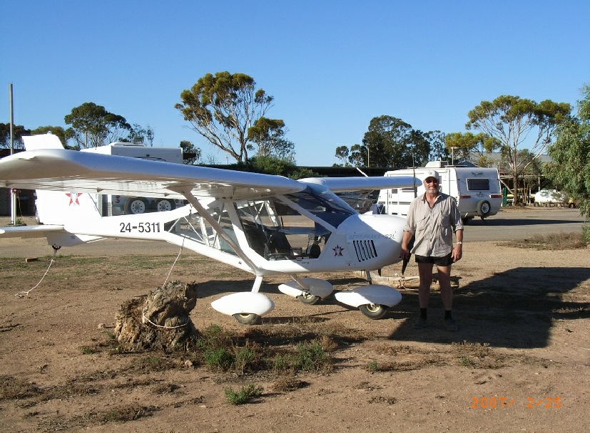
Figure 2. (Left) Peter Harlow and (Right) CFI Kevin Walters.
The start had been planned for first light Friday 22nd February although I did have a few dramas the night before as I didn’t tell the place where I was staying that I would be in for that night and so I had to find refuge with Noel and Steve at their boarding place. That worked out well as we all got up together quite early. It was a restless sleep for me as I was a bit worried about the next day, not because of the accommodation. We arrived at Redcliffe airstrip and we did the pre take off checks, fuel, oil, etc and then departed to the first place called Watts Bridge. It is a pity that I didn’t set the date in the camera (1 year too early) also date and time in the G.P.S. I was using to keep a track of my movements as then I could’ve recalled any data and time but the other data recorded was correct like ground speed, direction, height above sea level, etc.
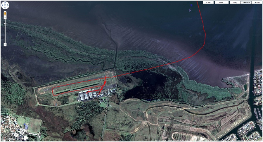
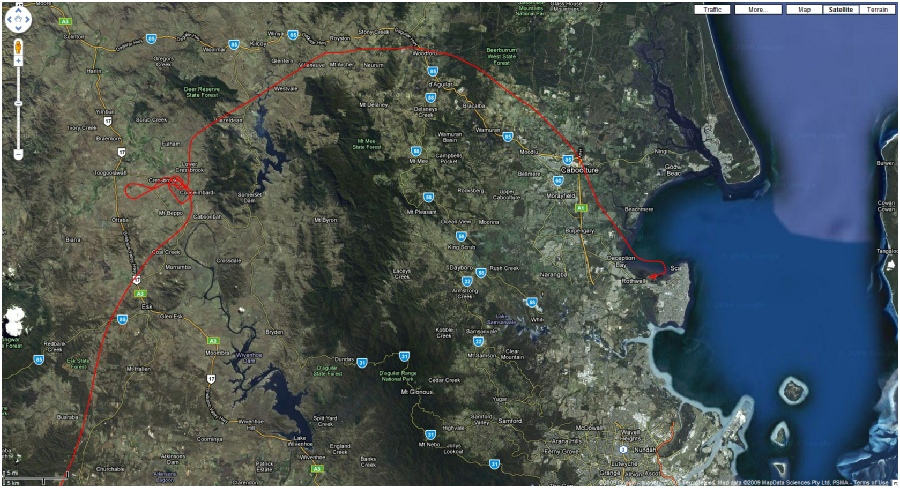
Figure 3. Redcliffe airstrip QLD (near Brisbane)
Figure 4. Redcliffe (Qld) to Watts Bridge track.
The weather was nice, not much wind and so we headed NW to a gap over the mountain, the Tecnam was a quite a bit faster than the Foxbat, so he disappeared into the horizon ahead of me, and at that time of the flight, I didn’t know that the VHF aircraft radio had an intermittent fault on it where it sometimes only sent out the carrier wave with no modulation, the UHF CB one was OK though. The cloud got closer to the ground as we climbed up to the pass, I reckon to about 700 feet and we got over it to see a flat area and quite low cloud, Steve gave a call on the radio and said they were putting down at Watts River until the cloud lifted a bit, I did have a little trouble locating the field but eventually I saw it and landed a little far down the strip than I would have liked but was all OK, we rested for about an hour before we headed to Goondiwindi via Toowoomba
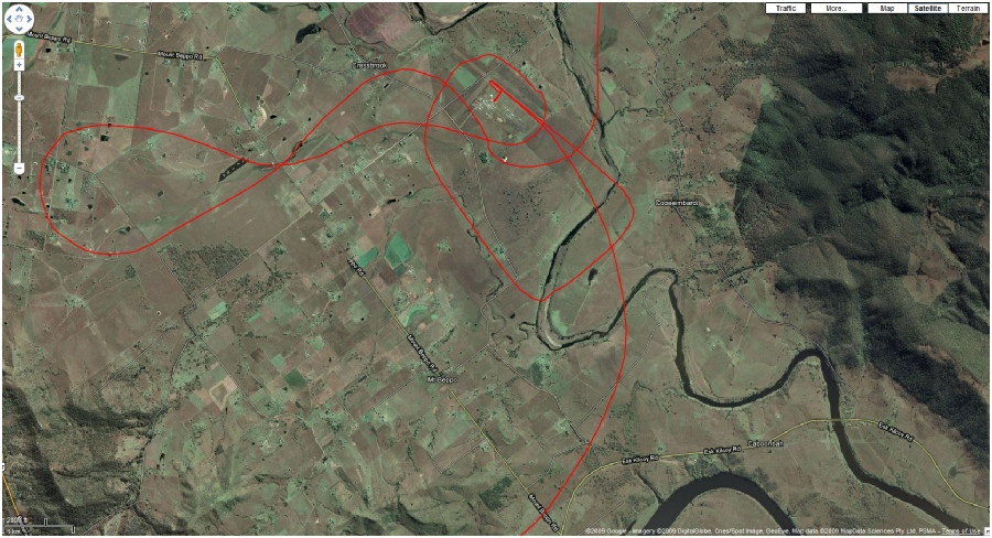
Figure 5. Where is Watts Bridge.
As I remember, the day was nice and all the fog/cloud had cleared and my nerves had settled down I enjoyed the leg to Goondiwindi, I did have a few thoughts of all the tiger country I was travelling over, (for those who don’t know what tiger country is, it's a place that if you try to land, the trees and terrain try to come and eat you) but after 2 hours of flying from Watts Bridge, we arrived at 8:30am 22nd Feb 2008 to fill up. One good thing about text messages, they were waiting for us to arrive
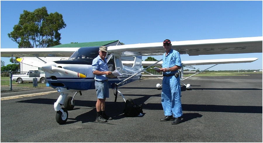
Figure 6. (Left) Noel Halden (right) Steve Vette.
Figure 7. Myself at Goondiwindi refuelling.
The next place on the flight plan was Narramine via Moree, we passed over a lot of little airstrips on the way as was the plan to keep these as possible emergency stops. The landscape was good (I thought) as we had got out of the tiger country and into the farming area and I felt a lot more at ease, the trip went good and took about 3 ½ hours and so we landed, refuelled and headed for Hay.
We left Narramine and flew at about 6500 ft (as west is evens), we got about an hour SW from Narramine, the wind got stronger from the west and then I could see the dust being stirred up from the ground (2:36 pm 22nd Feb 2008), after a chat to Steve and Noel, we diverted a little more north of the dust to keep out of it and I climbed to 8500 ft to try to get out of it, but we slowly crept into the dust, I remember looking at the GPS ETA (estimated time of arrival) to Hay, it remained about at 2 hrs 10 minutes for about 15 minutes flight time, so after a call to Steve and a bit of discussion, we decided to turn back to the nearest airstrip and then we decided to go back to Narramine
Figure 8. Dust storm halfway to Hay from Narramine (bit scary).
On the figures that the GPS gave me, the trip was averaging about 100 kts airspeed (180km/hr) and about 60 knots/hour (110 km/h) ground speed heading about 240 degs, till we turned back then at 307 degs, my ground speed was (33 km/hr) then a little later while I was trying to find the nearest airstrip, my heading was 090 deg and ground speed of 170 kts (320 km/hr). I don’t mine admitting it, but I think we left our turn a bit late, I think we should’ve turn back when we first saw the dust. After I got Narramine into the GPS and the Magnetic compass looked good, I descended slowly into the dust to about 3800 ft (odd thousands for east) and I could see the airstrip of Condobolin below and thought to myself, I would not like to be landing there, one strip (01/19) was sealed and the other (10/28) was gravel and there was a plane there, I guess it was well tied down, we were now doing about (200 km/h) and increased to 250-280 km/h and then, to my surprise at Narramine, there was bugger all wind, the whole trip took about 2 hr 35 minutes and the return took 45 minutes. I was pleased to book into the room at the strip and the club was open being Friday night, so I really enjoyed a beer (or six, he he). That was the first day of my trip and what an eye opener….
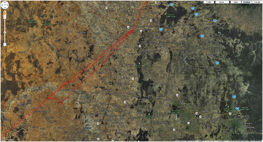
Figure 9. Narramine & U turn back due to duststorm.
I was very impressed with Narramine as it had all the facilities that only pilots would dream to have in their home town, having accommodation like onsite caravans motel room and a club and great friendly people.
After a good night rest and sleep, we checked the weather as we did the previous day, but now they mentioned there was a dust storm the day before near Hay, but said it had cleared, so we took off just after first light to Hay. The Tecnam got about 10 minutes ahead of me in the 2 ½ hr flight and they had landed and refuelled by the time I got there, I remember that the air was warming up and quite bumpy for landing.
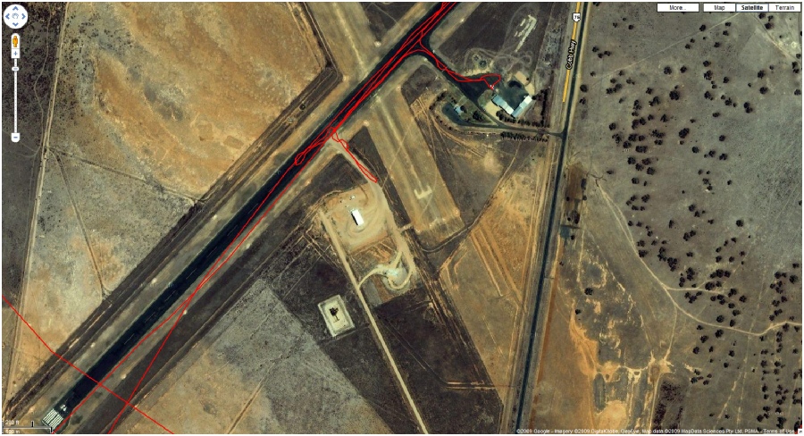
Figure 10. Refueling at Hay.
The next leg was to Renmark via Mildura and at this stage I was still unaware that the radio was intermittently not transmitting audio, as we took off at Hay, I had troubles contacting Steve and Noel so I went onto the UHF CB unit and talked to him there and went back listening to the VHF aircraft unit, he said that they were going to refill at Waikerie and I said to him that there was no fuel normally, only on gliding weekend if you were lucky, but I didn’t know that they hadn’t heard me and I wondered why they didn’t confirm the conversation, but it had happened previously and I thought it was their manner, not thinking it was my radio. I arrived overhead at Renmark after a 3 ½ hr flight and couldn’t see them so I doubted myself I was at the right airstrip but I landed at there in the thermal conditions and wondered where they were. After I had organized with the attendant to refuel, I got a phone call from Noel saying there was no fuel at Waikerie (about 30nm ahead of me) and where was I, after they trekked back 30nm to Renmark, they met me and refueled themselves. Now we headed to Pt Augusta (a 3 hr trip) via just south of Peterborough and north of Jamestown and Port Pirie.
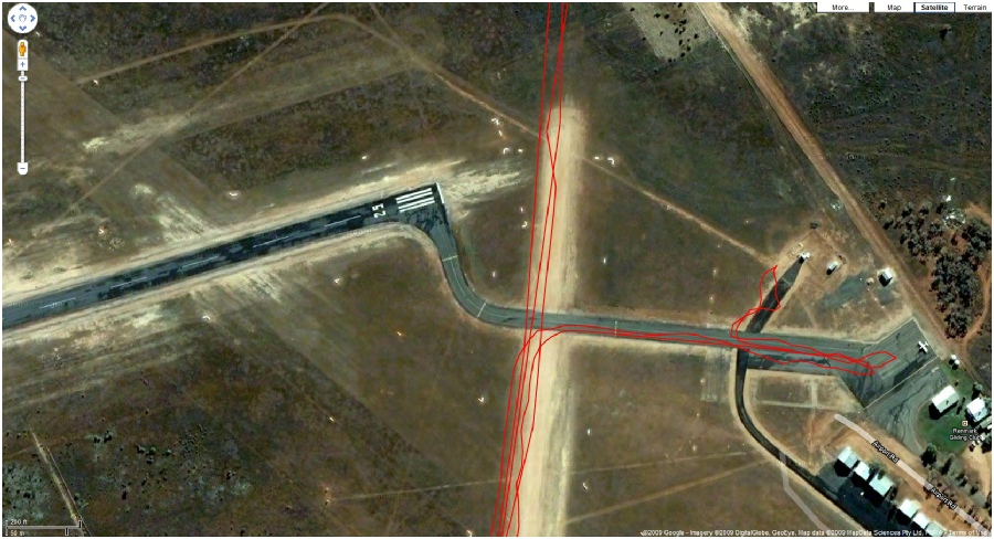
Figure 11. Refueling at Renmark Airstrip.
There was quite a lot of tiger country from Hay to Pt Augusta but the trip went well I thought and I could see the Flinders Ranges in the distance. I seemed to always pick the 4500 feet above sea level to fly at but on this leg because of the tiger country, I picked 6500 ft, and as I could quite easily see Peterborough to my left front and Jamestown on my right front, the GPS said it had lost the satellite, after unplugging it and re-powering it, it started again, for only a little while, I didn’t think I could get lost as the Flinders Ranges were quite prominent ahead, magnet bearing looked good and my PDA GPS was trusty (the one that recorded the GPS track) and we were in sort of farming country at that stage. After the Garmin had failed a few more times, I leaned back and got the spare Garmin and swapped it for the one in the dash that had stopped working, that too failed many times, this had me baffled and I didn’t know at that time that the radio was causing spurii and upsetting the GPS because of the close proximity of the radio and GPS antenna.
To make the plane fly a bit more level, I used the fuel out of the tanks on my side (pilots side) and the weight of the fuel on the other side gave enough weight so as I didn’t have to hold the ailerons to that side as much (I did correct this a bit with the manual aileron trim tab later), but because I was tied up with the GPS stuff, I didn’t check the fuel as much as I should and then half way up the Adelaide hills I smelt raw fuel and the low pressure fuel alarm come on the Dynon engine management unit, I looked out the passengers window just to see fuel pouring out of the tanks over flow, all above TIGER country too. Not sure even until today why the low pressure alarm came up but as I was using the fuel from their left side and the excess fuel return line goes to the right tank, it caused it to overflow, catch for “young” players. I swapped tanks for a while and all was good and I settled down to a delightful trip over the Flinders Ranges, the highest I got over the hills was about 6000ft and there was plenty of room under me to the peaks, I descended to 4500 ft after the ranges and had Port Pirie on my Pirie left then I turned north and followed the coast above the Princess Hwy. I did really find this bit relaxing, looking at the scarp and sea, looked low lying country with sand, etc.
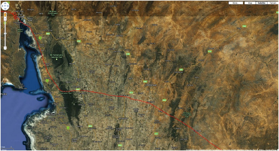
Figure 12. Flinders Ranges.
I arrived at the Pt Augusta airstrip probably about 15 minutes after Noel and Steve and was excellent conditions and so I managed a greaser of a landing for them. We both refuelled the aircrafts and tied the planes down, caught a taxi to town and had a good restful night.
Next day, we got to the hangar and it was still dark, there was a big shed, which I think used as a overnight hangar and it had lights so it came in handy for the pre take-off checks, in hind site, I wished I’d taken off first because I was always 10 to 15 minutes behind the Tecnam after each flight, and I always seemed to be hurrying, the next leg to Ceduna took 2 ½ hrs but what I was aware of was the speed that the fronts come in from Pt Lincoln. When I got about an hour into the flight across the tiger country, the low fuel pressure alarm came up and went, at that stage, I gave Steve and Noel a call and they said they were up at 6500 ft and it was calm and blue, but there was a reasonable amount of clouds where I was but because I had the fuel alarm and was over tiger country and was only at 4500 ft, I decided to go to 6500, in the picture below, you can see a blob on the trail just below Lake Gairdner, well that was where I went up to 6500 ft but just saw a new world of bubbling white cotton balls below me to I high jacked it out following my break in the clouds downward. As I got closer to Ceduna, Gawler Rangers, I was down to 2300 ft and the cloud was forcing me down and that continued to happen and when I got to Ceduna, I was just below the cloud at 1800 ft. The radio played up again, when I was coming into Ceduna, I saw Steve and Noel coming in to land, I heard them OK on the radio and I asked them about landing downwind (what there was of it) and why they did this but with no reply, so I landed into wind and refuelled then parked up and tied down at 8:19am 24th Feb 2008, just as it started to drizzle.
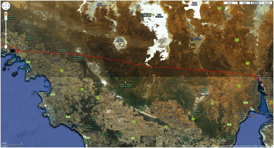
Figure 13. Pt Augusta to Ceduna leg
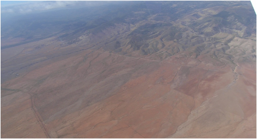
Figure 14. Tiger country halfway from Pt Augusta to Ceduna.
We went into Ceduna in a taxi and had a meal and I brought some tools, screwdriver and spanner and also, the reason why I caught up was, when questioned them on whether they heard me on the radio, I found out that Noel and Steve went to an old airstrip.
We were on our way by 11:15am Feb 24th 2008, leaving Ceduna and of to the Nullabor, a 2 hr trip and all went really nice and calm, sitting on 100 knots with a good tail breeze and sitting at 2500 feet admiring the scenery, I mainly followed the roadway and it gave me security and comfort thinking that if anything went wrong with the fan, I could land on the road. The weather was a little warm but only a max of 26 in the cabin but the landing at the Nullabor showed a few signs of thermals happening. Filled up with fuel about 1pm 24th Feb 2008 and a bite to eat.
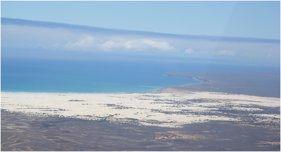
Figure 15. Looking west to the Nullabor Roadhouse
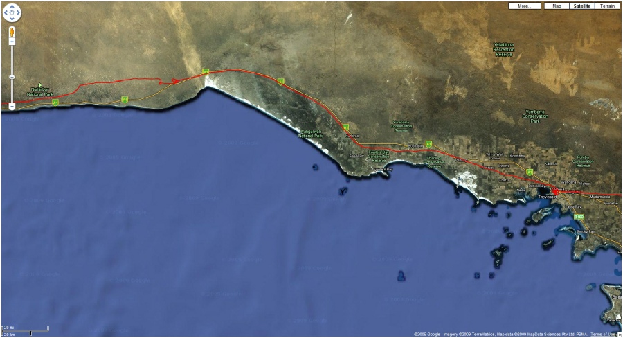
Figure 16. Ceduna to The Nullabor Roadhouse track.
Figure 17. (left) Noels’ Halden's Tecnam, (Right) My Foxbat at The Nullabor Roadhouse.
Next leg, Nullabor Roadhouse to Border Village. Once again, a nice trip
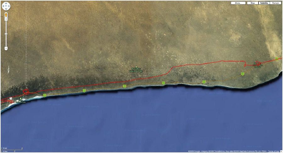
Figure 18. Nullabor Roadhouse to Border Village.
When I got to Border Village, I can’t remember why, but I was ahead of the Tecnam, (must have taken off first I guess), but, as it happened, I did a good cross wind landing there on the tiny, narrow airstrip and I was so pleased, for some reason, I give her a bit of throttle and then had to go around, I did call on the radio to let Steve and Noel know but muffed the second landing a bit. We both filled up and then took off and started to head for Caiguna, but I got about (8km) west of Border Village and the engine oil pressure showed zero and the alarm was on, luck as fate would have it, the Eucla strip was just behind me so I swung around and landed on one of their many strips. We all stayed the night and after a morning of organizing a mechanical gauge, found out the failure was only in the oil sender unit (I had to fly back home with that damn nagging gauge not working)
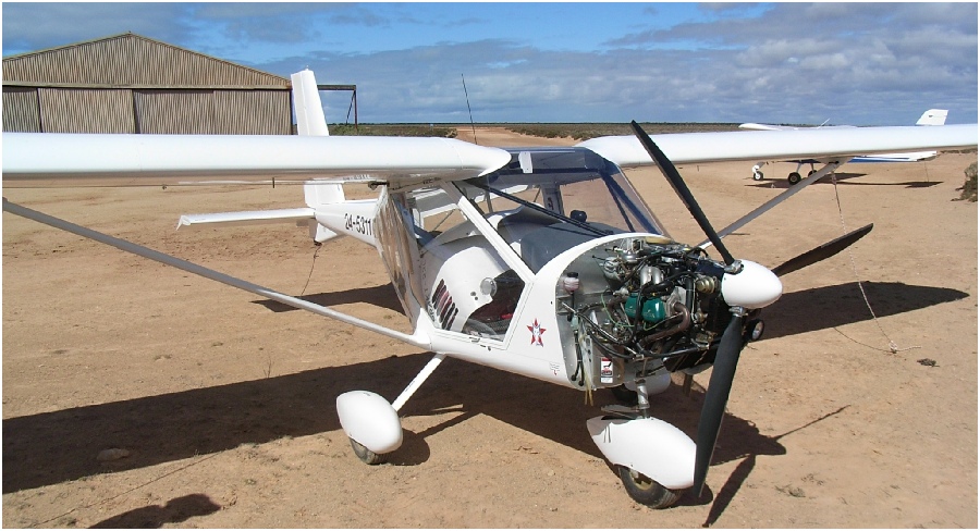
Figure 19. Checking out the oil pressure guage at Eucla.
Figure 20. Eucla to Caiguna landscape.
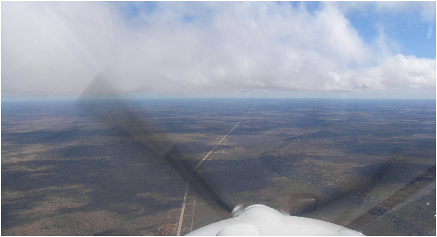
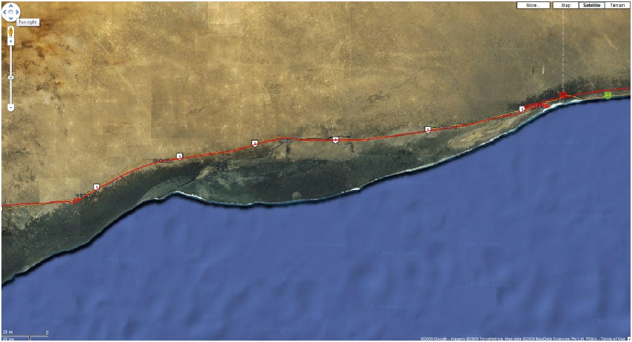
Figure 21. Eucla to Caiguna.
Next Morning, after we had proved it was all A OK, we packed up and left Eucla about 1pm and after a 2 hr trip, mostly following the road talking to the motorists on UHF CB, over flying Madura, Cocklebiddy Motel, staying around the 4500 ft mark until I arrived at Caiguna, we had a cup of coffee and Noel and Steve decided to push on to Norseman, but I decided that I didn’t want to because I was heading to Esperance and I would have to stay there the night and the airstrip was 11 km out of town and Caiguna was so convenient, so I relaxed in the barmy sun and checked over the machine then sat back and had a well earned beer.
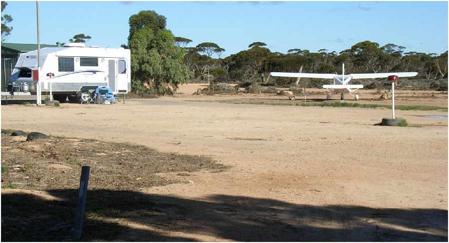
Figure 22. Caiguna, 5:33pm 25th Feb 2008.
At daybreak, I was ready for the final leg/s, I rang the Esperance Airstrip at 6 am and they said it was “Cavok” so I told him I would be there at 9am (I ended up getting there 2 minutes early) so I took off, I remember that the wings were a little wet from dew and I had to wipe them down, but on take off, it seemed to take ages to get off the ground, and I reckon there must have be water in other places on the plane, weighing it down.
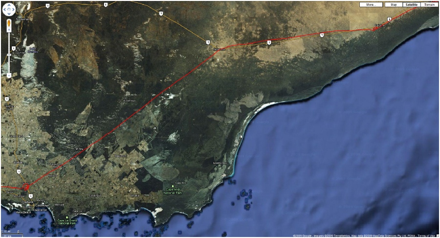
Figure 23. Caiguna to Esperance
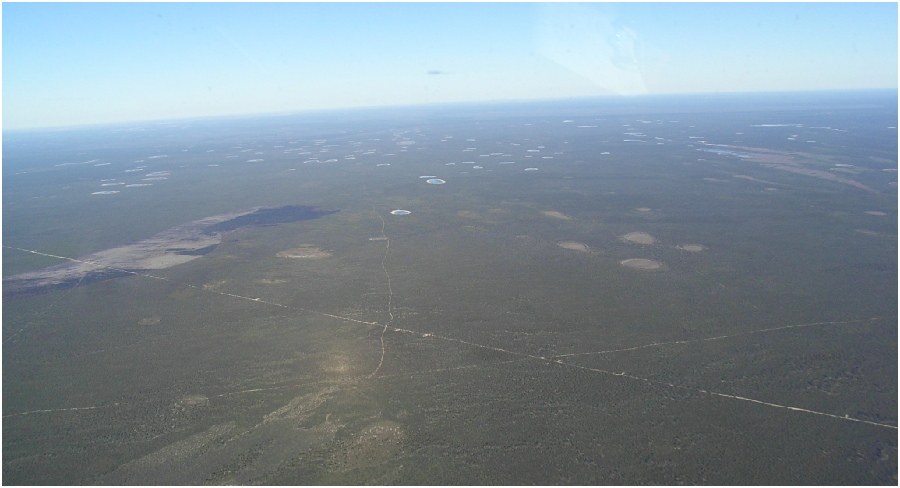
Figure 24. Lakes between Balladonia & Esperance.
The trip to Esperance was worrying because it was all tiger country except for a few salt lakes, but other than that, I found it most enjoying as I didn’t have to push myself and the craft to keep up with the Tecnam, I throttled back about 10 knots to about 90 kts airspeed and still only took 2 ½ hrs for the trip. Esperance airstrip had a bit of a gradient on the western end, and that on landing, it become apparent.
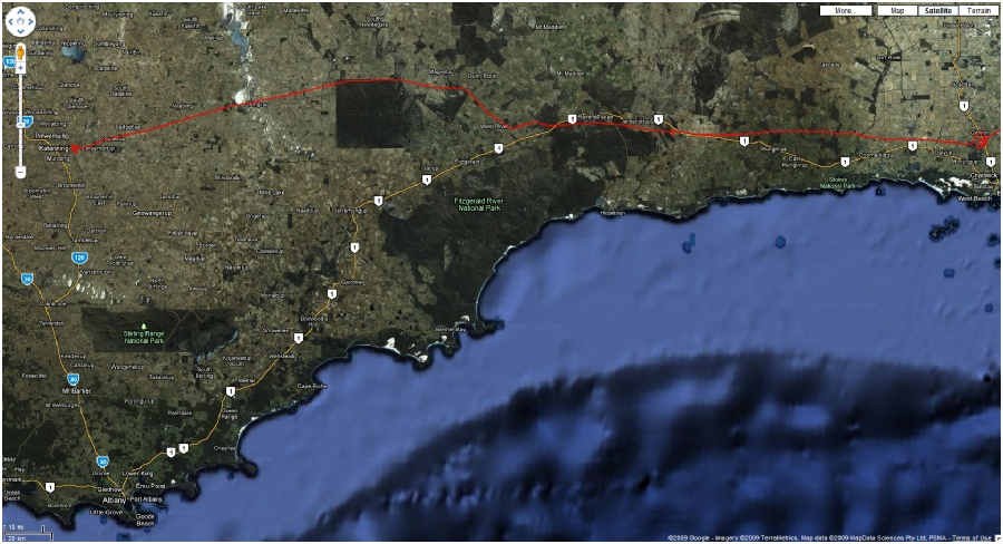
Figure 25. Esperance to Katanning.
I filled up with fuel and checked things over for the last 2 ½ hr leg to Katanning. At 10:20am, I sent my brother (Dennis) a text saying I will be going over the mine (where we both worked at that time) at 10:24 and so I dropped down from 4500 ft to 2500 ft (should have gone lower) and circled the mine then went on my way (you can see the little dot on the track over the mine).
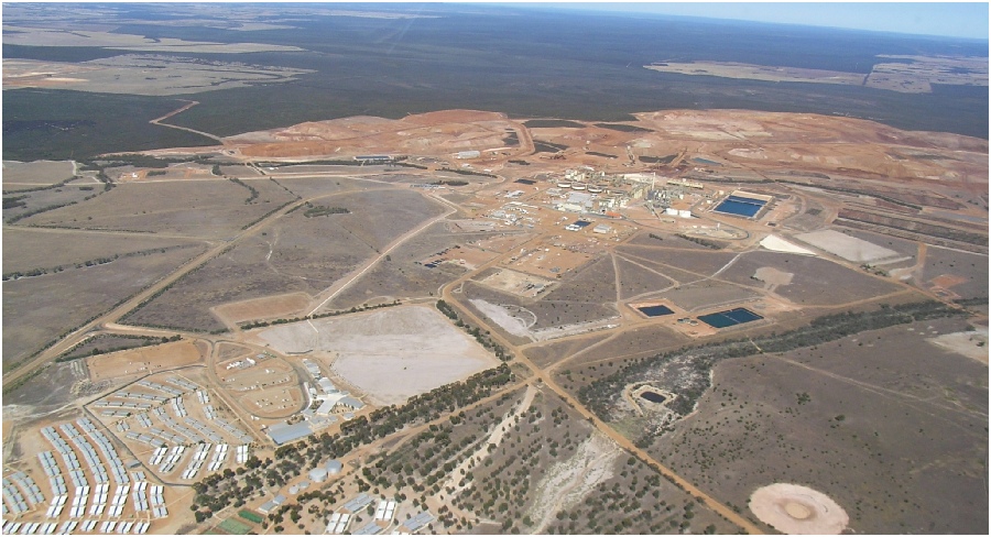
Figure 26. Raventhorpe Nickel Mine WA.
I got to Katanning about 12:30pm, my Brother (Trevor) was there waiting for me to arrive, it was 33 deg and bumpy, I was a bit tired by then, much to Trevor's disappointment as he wanted a ride in the plane. He took me to our house and we had a beer together.
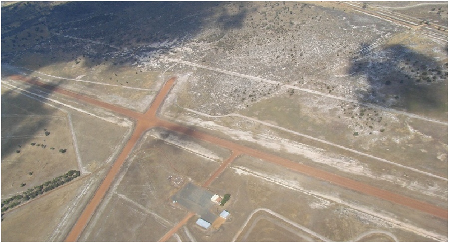
Figure 27. Katanning Air Strip.
Home again, Home again, Jiggerty Jog..
 Download my whole trip
You can have a look at the whole trip in detail as the GPS saw it, Location, ground speed, time and direction and more, just load it into Google Earth on your computer if you wish, just download the .kml file
- Queensland to Katanning.mp3
| An Enjoyable Trip |
| Aviation Events & Links |
| Wagin Airstrip |
| Katanning Weather |
| Katanning Sale Yards |
| 6WA |
| Mothers Memiors |
| Carmans Memiors |
| Amateur Radio |
| opps |
| Other stuff |
| Suns Azimuth Tracker |
| Sun Solar Tracker |
| Suns Elevation Tracker |
| leaf rake |
| windrow rake |
| Fire Lighter |
| Oil Heater |
| Yamaha HS6/8 |
| Power Monitoring |
| Stappleton Station Bores |
| Smithvale UPS |
| Tank Water Level |
| Smith Family Stuff |